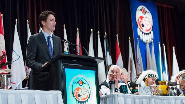
 Prime Minister Justin Trudeau delivers a speech to the Assembly of First Nations Special Chiefs Assembly in 2015 [source: Prime Minister of Canada.pm.gc.ca website]
The Arctic has a land area of approximately 14 million square kilometres, which falls under the sovereignty of eight states: Canada, the USA, Denmark (Greenland and Faroe Islands), Iceland, Norway, Sweden, Finland and Russia. It is also home to around 4 million people, with indigenous peoples accounting for around 10% of its population. Canada has more Arctic land mass than any other country, and the Canadian Arctic Archipelago is the world’s largest high-Arctic land area after Greenland. With indigenous people accounting for over 50% of its population in its north, Canada is again surpassed only by Greenland in this respect. Canada is also the only Commonwealth country that is a member state of the Arctic Council, the principal multilateral forum in the region.
Indigenous peoples had lived across the circumpolar north long before the advent of European explorers and settlers and the introduction of modern empires and nation states there. However, they were often excluded from border-making processes and consequently found themselves and their traditional spaces—whether homelands or spaces of historical, religious, social or economic significance—within different empires and/or nation states, or straddling imperial and/or national boundaries. Owing to the imposition of national borders in the region, the Inuit today live in four states (Greenland, Canada, Russia and the USA), as do the Saami (Norway, Sweden, Finland and Russia). Likewise, the Yup’ik and the Unangax (Aleut) live in Alaska and the Russian Far East, while the Athabaskans and Gwich’in are spread across Canada and the USA.
As relations between the empires and/or nation states evolved, indigenous peoples divided by borders could find themselves operating within potentially conflicting political entities. The Bering Strait Region is a case in point. During the Cold War, the Ice Curtain greatly divided communities—such as those of the Iñupiat, Yup’ik and Unangax in the Diomede Islands and the Aleutian Islands—that straddled the Russia–US border. Likewise, after the Thirteen Colonies in British America declared independence as the United States of America and waged the American Revolutionary War, many indigenous peoples and their traditional homelands were split by the international boundary drawn between the USA and the British Empire. It would mark the beginning of a long process by which that boundary line would be negotiated, defined, extended, contested and adjusted repeatedly to become the US–Canada border as we know it today.
Borders could also affect traditional cultural practices, such as the potlatches of the indigenous peoples of the Pacific Northwest. The boundary between the Alaska Panhandle and British Columbia split the Tlingit, Haida and Tsimshian and subjected them to different legislation, with their potlatches potentially assuming a cross-border dimension. Both Canada and the USA had potlatch bans in place since the late nineteenth century until their repeal in 1951 and 1934, respectively. Today, indigenous people crossing borders with customary food and gifts (including artwork featuring animal parts and pelts) for potlatches may face challenges at the border due to customs laws concerning the import of certain goods.
Dwayne Ryan Menezes is the Director of the Polar Research and Policy Initiative.